
The Silk Road & Iran
For fifteen hundred years every caravan from Xi'an to Antioch had to cross the Iranian plateau. Parthian, Sasanian and Safavid Iran built the road, taxed it, and shaped what travelled along it.
Why every road met in Iran
Look at any physical map of Eurasia and the reason is obvious: between the Tian Shan and Pamir mountains in the east and the Mediterranean coast in the west, the Iranian plateau is the only continuous land that a loaded camel can cross. From the second century BCE, when Chinese envoys first reached Parthian Iran, until the 15th century, when ocean shipping made the overland route obsolete, every Silk Road merchant had to deal with an Iranian power.
"The land of Anxi [Parthia] is several thousand li in extent. Its people till the soil and have walled cities. Their trade is by silver coins... Their merchants travel by land and by sea to every neighbouring country."
What Iran added to the road
Iranians were not just gatekeepers; they were participants. Sogdian Iranians from Samarkand and Bukhara were the road's principal long-distance merchants for a thousand years — their language, written in an Aramaic-derived script, became the Silk Road lingua franca and travelled with their colonies as far as the Tang capital Chang'an.
Polo
Invented in Iran (chogan) — exported to India, China and the Byzantine court
Spinach
Domesticated in Iran; reached China in 647 CE as 'Persian vegetable'
Lute
Persian barbat → Arabic ʿūd → European lute and ultimately the guitar
Postal system
Achaemenid chapar relay; copied by Romans, Mongols and the Pony Express
Qanat
Iranian underground aqueduct technology spread to China, North Africa and Spain
Windmill
First vertical-axis windmills built in 9th-c. Sistan
The great Iranian way-stations
| City | Province / Region | Role |
|---|---|---|
| Merv | Khorasan (now Turkmenistan) | The 'queen of the world' — gateway from Central Asia |
| Nishapur | Khorasan | Turquoise, silk, ceramics; home of Khayyam and Attar |
| Rayy (Tehran) | Media | Hub of the route to Baghdad |
| Hamadan | Media | Ancient Ecbatana — Achaemenid summer capital |
| Isfahan | Persia | Safavid 'half the world' (Nesf-e Jahan) |
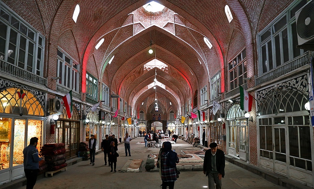
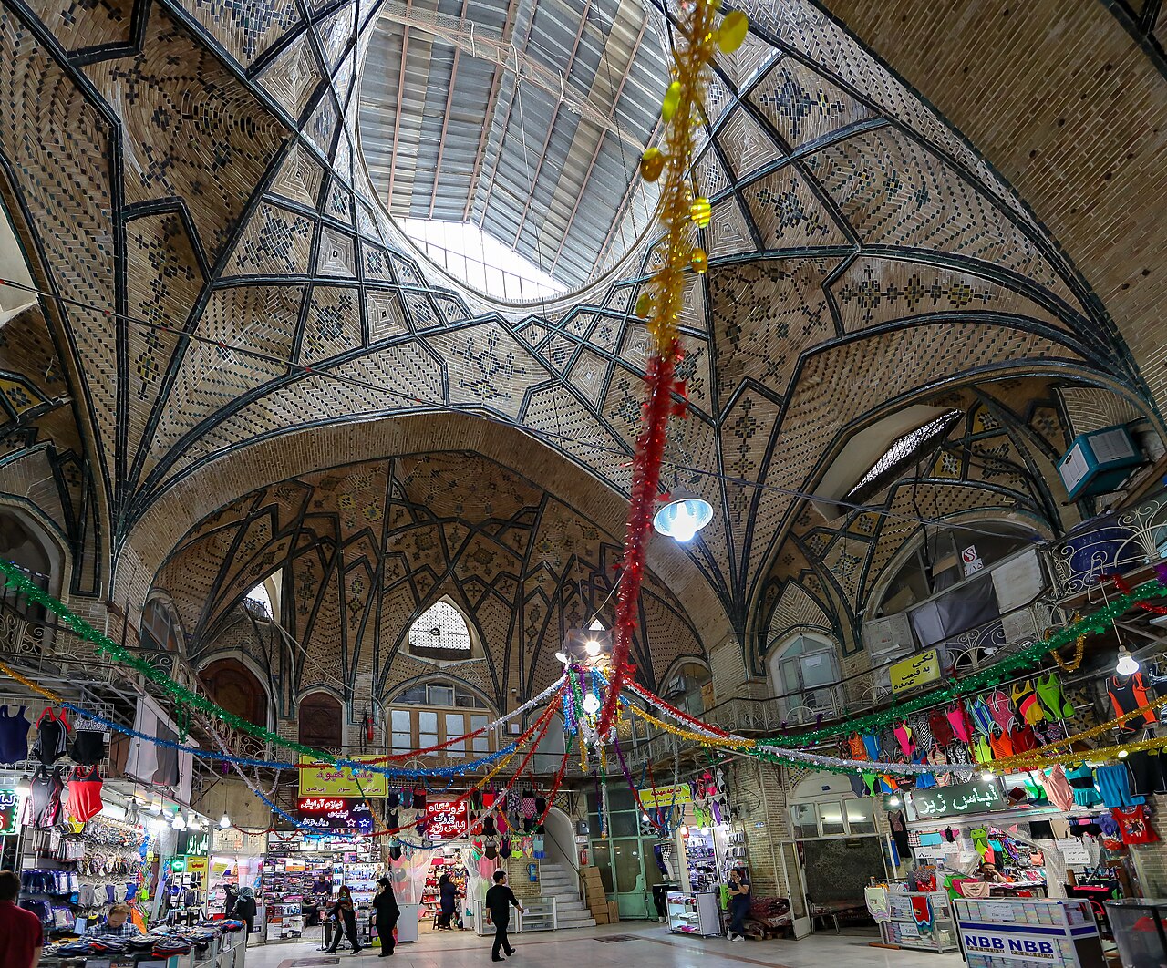
| Tabriz | Azerbaijan | Mongol-era capital; UNESCO bazaar complex |
| Yazd | Central plateau | Silk weaving centre; UNESCO Historic City |
| Hormuz | Persian Gulf | Maritime Silk Road terminus described by Marco Polo |
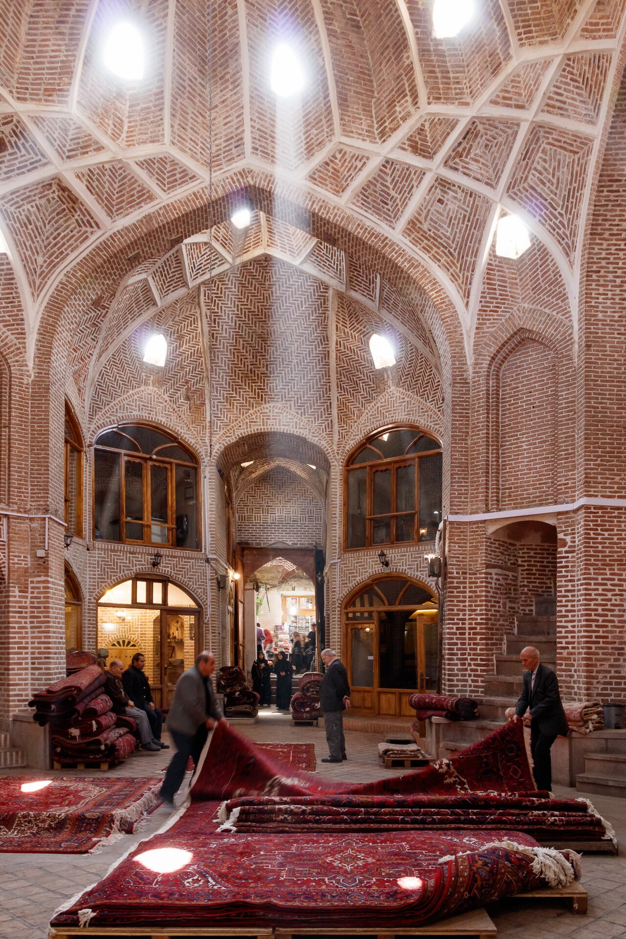
The 54 caravanserais of Iran
In 2023 UNESCO inscribed 54 Iranian caravanserais as a serial World Heritage Site — the densest surviving network of Silk Road infrastructure anywhere on earth. Built roughly one day's camel-march apart, the caravanserais offered merchants secure lodging, water from a qanat, stabling and protection from bandits. The Safavid shahs of the 17th century built or rebuilt nearly a thousand of them across their realm.
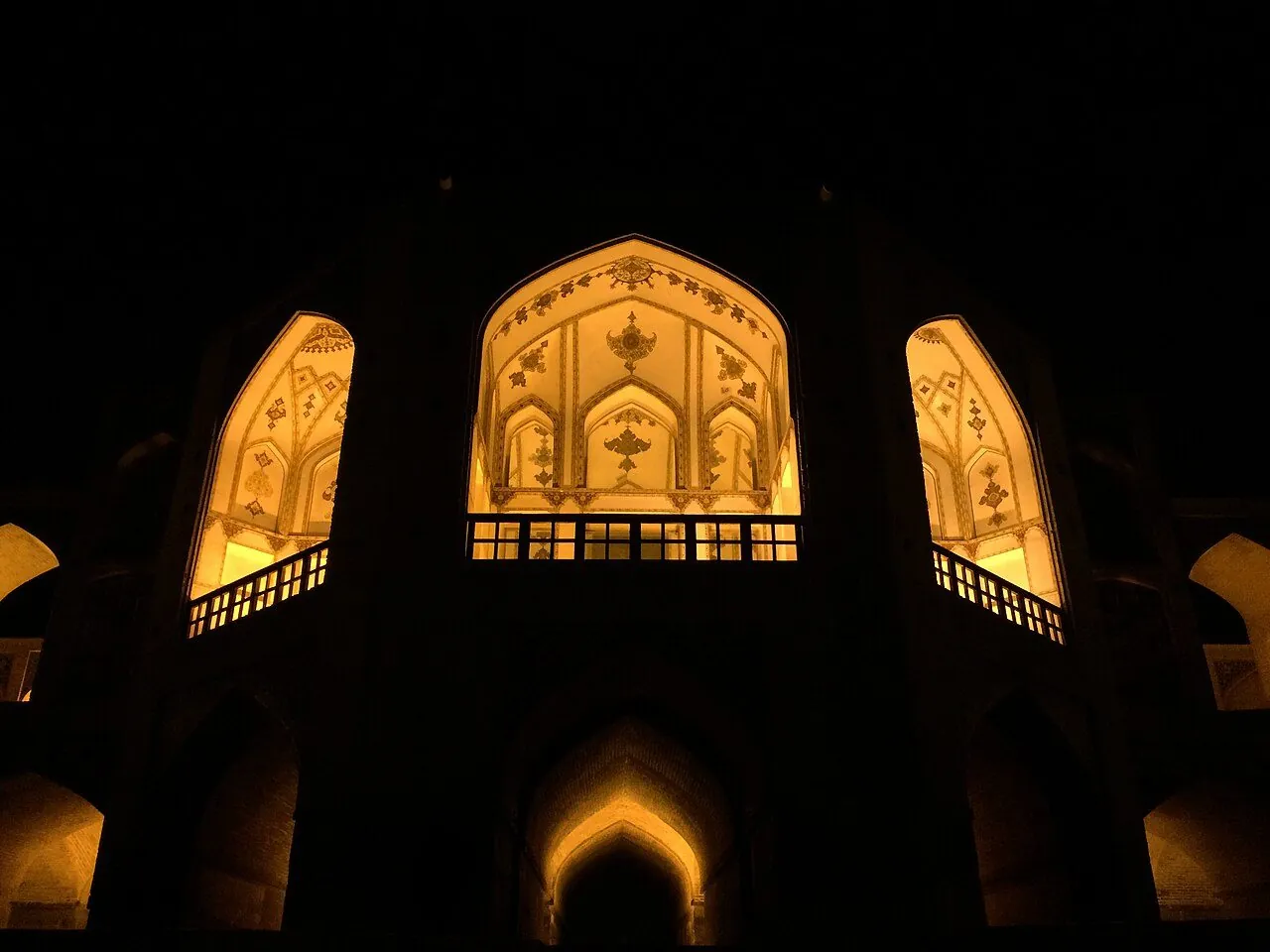
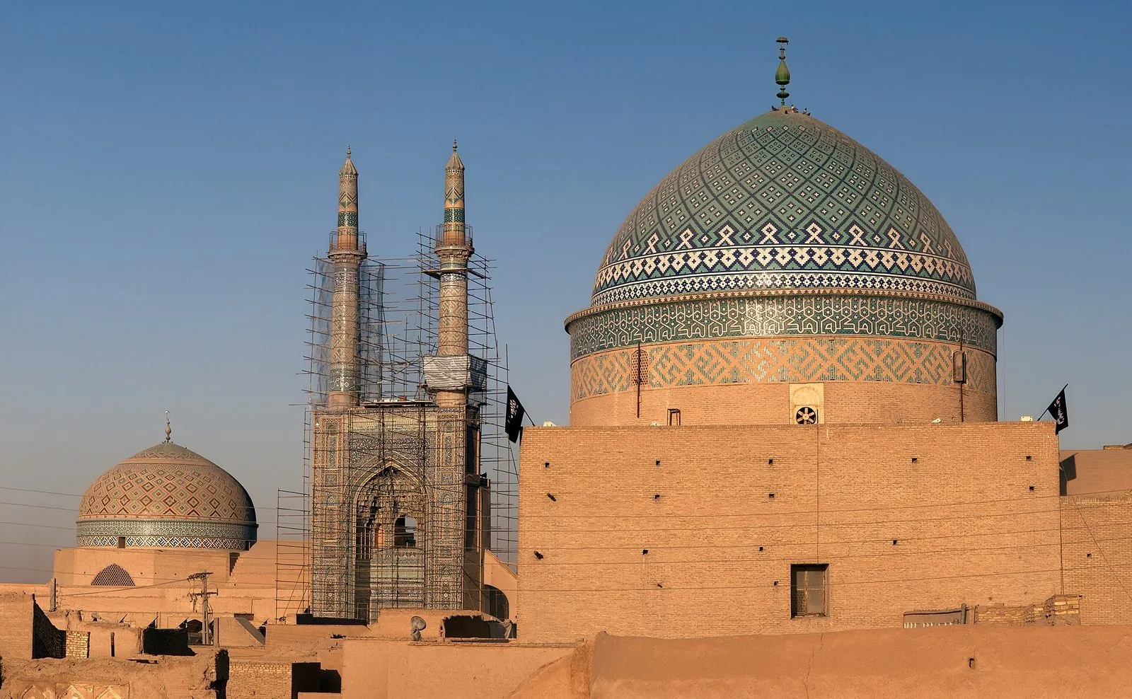
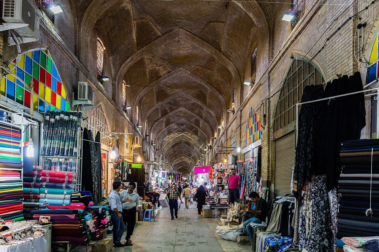
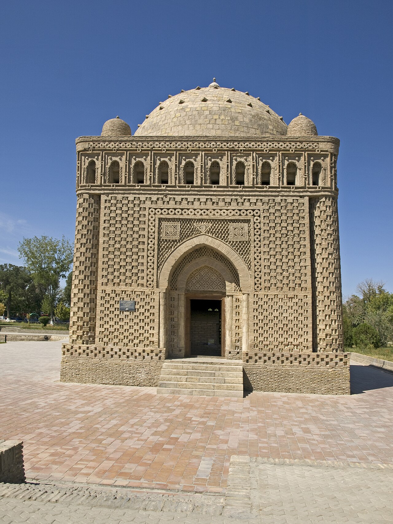
The Iranian plateau on the Silk Road
Caravanserais, bazaars and Samanid mausolea: the architecture that made Iran the land bridge of pre-modern Eurasia.
Images shown here are served from the local media library.
Frequently asked questions
Related reading
From Elam and the Medes to the modern era — a continuous 5,000-year story.
Achaemenid, Parthian, Sassanid, Safavid, Qajar — six successive Iranian empires.
Persepolis, Isfahan, Yazd — domes, gardens, badgirs and caravanserais.
Provinces, top sites, four seasons and eleven climate zones.
Iran's 27 UNESCO World Heritage Sites — map, dates, photographs.
Inventions, governance, infrastructure — qanats, postal system, Charter of Rights.
References
- ↗ UNESCO — Persian Caravanserai (2023)
- ↗ Encyclopædia Iranica — Silk Road
- ↗ Susan Whitfield — Life Along the Silk Road (British Library)
All imagery is sourced from Wikimedia Commons, public-domain museum collections (British Museum, Louvre, Metropolitan Museum of Art, National Museum of Iran), or UNESCO World Heritage records. No AI-generated images are used. Scholarly text is synthesized from Encyclopædia Iranica, the Cambridge History of Iran, and peer-reviewed publications.